- 0
- 826 words
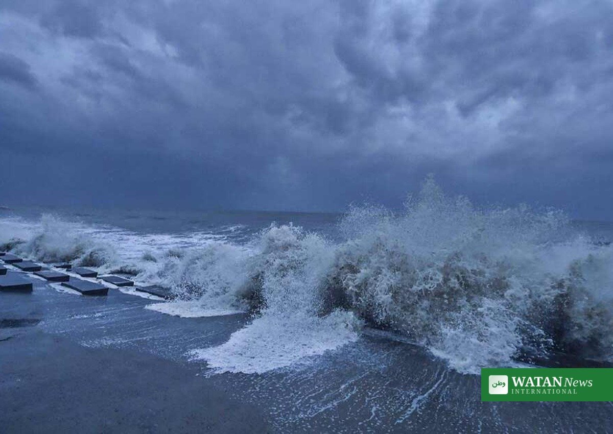
Cyclone Murasu, which formed over the Bay of Bengal on Sunday, 1 November, is heading for India’s Andhra Pradesh coast and is expected to strengthen into a severe cyclonic storm before crossing land late on Monday night, the India Meteorological Department (IMD) said.
FAKTA
- Cyclone Murasu formed on Sunday, 1 November, after a deep depression over the southwest and adjoining west-central Bay of Bengal intensified into a cyclonic storm.
- The IMD expects it to become a severe cyclonic storm around Monday morning, 2 November.
- It is forecast to cross the south Andhra Pradesh coast between Nellore and Narsapur, close to Ongole, between 11:30 p.m. on Monday, 2 November, and 4:00 a.m. on Tuesday, 3 November.
- At landfall, sustained winds of 100 to 110 kmph are expected, with gusts reaching 120 kmph.
- It is the second cyclonic storm to threaten the same coast in less than a week, after Cyclone Arnab crossed near Narsapur on 28 October, killing seven people.
Cyclone Murasu: Where the Storm Is Now
At 11:30 a.m. IST on Sunday, Cyclone Murasu lay centred over the southwest and adjoining west-central Bay of Bengal, about 560 km east-southeast of Chennai, 630 km east-southeast of Nellore, 640 km southeast of Machilipatnam and 680 km east-southeast of Ongole, the IMD said. By 2:30 p.m. IST, its centre was near latitude 12.4 degrees north and longitude 84.6 degrees east, about 480 km east-southeast of Chennai and 550 km east-southeast of Nellore, moving west-northwestwards at about 27 kmph.
The name Murasu, meaning drum in Tamil, was contributed by India. The IMD has issued a cyclone alert for the Andhra Pradesh coast and the adjoining north Tamil Nadu coast, and has advised fishermen not to venture into the sea.
What the Forecast Means for the Coast
The storm is very likely to move west-northwestwards and intensify into a severe cyclonic storm over the west-central Bay of Bengal around Monday morning, before turning northwestwards towards the coast, the IMD said. Squally winds of 40 to 50 kmph were expected along the coast on Sunday evening, rising to gales of 65 to 75 kmph by Monday noon and 80 to 90 kmph by Monday evening, with the strongest winds from midnight on Monday night to Tuesday noon.
Heavy rain is also expected. The system is likely to bring moderate to heavy rainfall, with isolated extremely heavy showers, over south and central coastal districts on 2 November, and heavy to very heavy rainfall on 3 and 4 November. Officials have forecast extremely heavy rainfall in 20 mandals on 3 November, including nine in Eluru district, five each in Krishna and NTR districts and one in Bapatla. Seawater about one metre above the normal tide is very likely to flood low-lying areas of south coastal Andhra Pradesh as the storm crosses, most of all in Bapatla, Krishna and Prakasam districts.

Second Storm in a Week After Cyclone Arnab
Cyclone Murasu arrives while coastal Andhra Pradesh is still recovering from Cyclone Arnab. The very severe cyclonic storm crossed the coast near Narsapur in the early hours of 28 October, with maximum sustained winds of 125 to 135 kmph gusting to 150 kmph. It claimed seven lives and caused widespread damage to crops, roads, electricity and telecom infrastructure, with preliminary losses estimated at Rs 4,600 crore. A central team is currently visiting the state to assess the damage.
That recent damage is why officials are moving early this time. Andhra Pradesh Chief Minister N. Chandrababu Naidu on Sunday directed officials to remain fully prepared for relief and rescue operations, cancelled his scheduled visit to New Delhi on Monday, and asked officials to issue cyclone situation bulletins every four hours and to prepare clear timelines for restoring power supply. Officials briefed him that the storm was likely to cross the coast near Bapatla on the morning of 3 November, and told him power supply in areas hit by Arnab would be restored everywhere by Sunday night.
Warnings in Andhra Pradesh and Odisha
In Andhra Pradesh, district authorities are reviewing shelter preparedness, food supplies and medical emergency kits, and disaster-response teams are on standby. Distant Warning Signal No. II was hoisted at the ports of Visakhapatnam, Gangavaram, Kakinada, Machilipatnam and Nizampatnam, while Krishnapatnam replaced that signal with Local Cautionary Signal No. III.
In neighbouring Odisha, the government has announced a high alert in the southern region, ordered evacuations from low-lying areas and hilly terrain as a precaution, and said rainfall would begin on 2 November and increase in intensity on 3 and 4 November under the influence of the cyclone.
What Happens Next
The IMD is expected to issue further bulletins as Cyclone Murasu strengthens over the Bay of Bengal, and the forecast track and landfall timing may still shift. Residents in coastal districts are urged to follow official advisories, avoid the sea, and move to safer places if local authorities issue evacuation orders.
For more news from Asia, see Watan News’s Asia coverage.
Source: IANS via New Kerala and Indian White Paper, based on India Meteorological Department bulletins.
Author

usmanch0013@gmail.com
Related Posts
Sudan’s Power Grid Nears Collapse as Drone Strikes Hit Northern Stations
- 0
- 566 words
Drone strikes have knocked out power substations in the northern Sudanese towns of Al-Dabbah and Abu Hamad, pushing Sudan's power grid towards...
Read out all
Nepal and Bhutan Seek Dedicated Himalayan Climate Agenda at COP31
- 0
- 1,063 word
Nepal and Bhutan have jointly proposed a dedicated COP31 agenda item on Himalayan temperature rise, seeking scientific studies, an annual mountain dialogue...
Read out all
Dakar 2026 Youth Olympic Games Open in Historic First for Africa
- 0
- 726 words
Senegal opened the Dakar 2026 Youth Olympic Games on 31 October, bringing an Olympic event to African soil for the first time,...
Read out all
Google, Microsoft, OpenAI and Anthropic Back One Shared AI Training Opt-Out for Publishers
- 0
- 789 words
Four of the world's biggest AI companies will honour a single robots.txt signal letting websites opt out of AI training, replacing the...
Read out all
Binance Resumes Withdrawals After Covering Bulk of Record $6.3 Billion Crypto Heist
- 0
- 714 words
Binance resumed withdrawals on Sunday after covering 95% of the $6.3 billion stolen in the world's largest digital heist, which the FBI...
Read out all
Iran Designates Britain’s Royal Navy and RAF as Terrorist Organisations in Reciprocal Move
- 0
- 732 words
Iran designated Britain's Royal Navy and Royal Air Force as terrorist organisations and classified MI6 as a hostile group on 1 November,...
Read out all