- 0
- 626 words
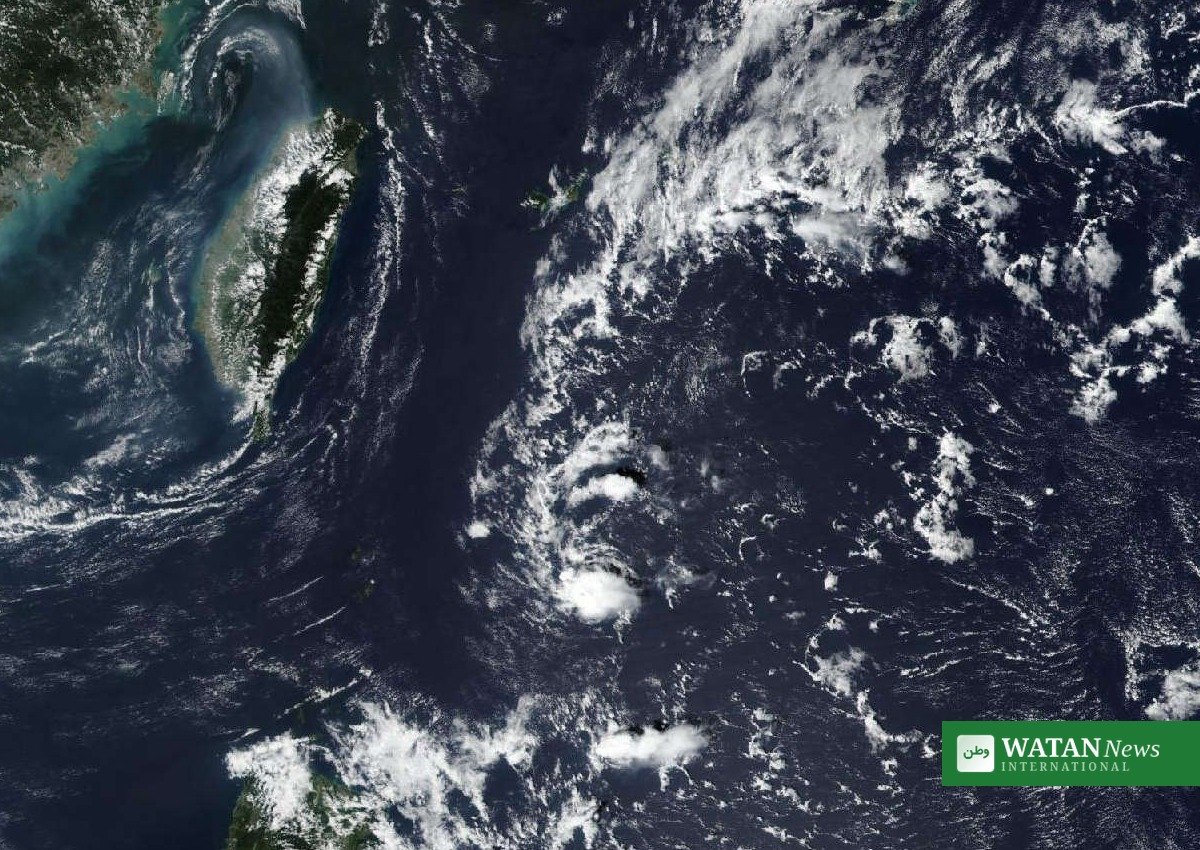
Typhoon Champi is expected to reintensify into a super typhoon on Monday evening, the Philippine weather bureau PAGASA said, as the powerful cyclone heads toward the Philippine Area of Responsibility (PAR), where it will be given the local name Rosal.
FAKTA
- Current strength: maximum sustained winds of 175 kph, gusts up to 215 kph (PAGASA 11 a.m. bulletin, Oct 19).
- Super typhoon Champi expected: winds exceeding 185 kph by Monday evening; peak forecast of 205 kph by Tuesday evening (PAGASA).
- PAR entry: Tuesday morning or early afternoon, Oct 20 — when it becomes the Philippines’ 18th tropical cyclone of 2026, named Rosal.
- Wind signals: Signals No. 3 or 4 may be raised over northern and eastern Northern Luzon and parts of the Bicol Region — Signal No. 4 means a severe threat to life and property.
- Track: after entering PAR, Champi is forecast to turn toward Taiwan while remaining over the Philippine Sea.
Typhoon Champi holds strength over the Philippine Sea
Typhoon Champi has maintained its strength while moving west-northwestward over the sea west of Guam, according to the Philippine Atmospheric, Geophysical and Astronomical Services Administration (PAGASA)’s 11 a.m. advisory on Monday. The tropical cyclone was located about 1,600 kilometres east of Southeastern Luzon, outside the Philippine Area of Responsibility, moving west-northwestward at 20 kph with strong to typhoon-force winds extending up to 720 kilometres from its centre.
PAGASA: Super typhoon status expected on Monday evening
Champi is expected to strengthen on Monday evening and reach super typhoon status, with maximum sustained winds exceeding 185 kph, PAGASA said. Under its 120-hour forecast, the storm is projected to peak at 205 kph by 8 p.m. Tuesday, Oct 20 — still outside PAR — and hold that intensity through Wednesday evening.
A live tracking analysis projects an even higher peak, near 270 kph, with one model (HAFS-A) depicting 285 kph at 24 hours, though forecasters caution that uncertainty around the storm’s eye-wall cycles could produce large deviations above or below the forecast trend.
Storm Signals No. 3 or 4 likely for Northern Luzon
PAGASA said tropical cyclone wind signals may be raised over the northern and eastern portions of Northern Luzon and parts of the Bicol Region as early as Monday evening or Tuesday morning. The highest wind signal expected under the current forecast scenario is Signal No. 3 or No. 4 — under these signals, winds may pose a severe threat to life and property.
Gusty conditions are likely to begin affecting most parts of Luzon, the Visayas and parts of Mindanao on Wednesday, Oct 21. Heavy rains are also expected in Extreme Northern Luzon, for which PAGASA said a separate weather advisory will be issued.
Sea conditions turn hazardous from Wednesday
Moderate to rough seas may begin affecting the northern and eastern seaboards of Luzon and the eastern seaboards of the Visayas and Mindanao by Tuesday. Hazardous sea conditions, with very rough to very high seas — maximum significant wave heights reaching 16.2 metres — may affect the northern and eastern seaboards of Luzon from Wednesday onward. A gale warning is expected to be issued on Tuesday evening or Wednesday morning.
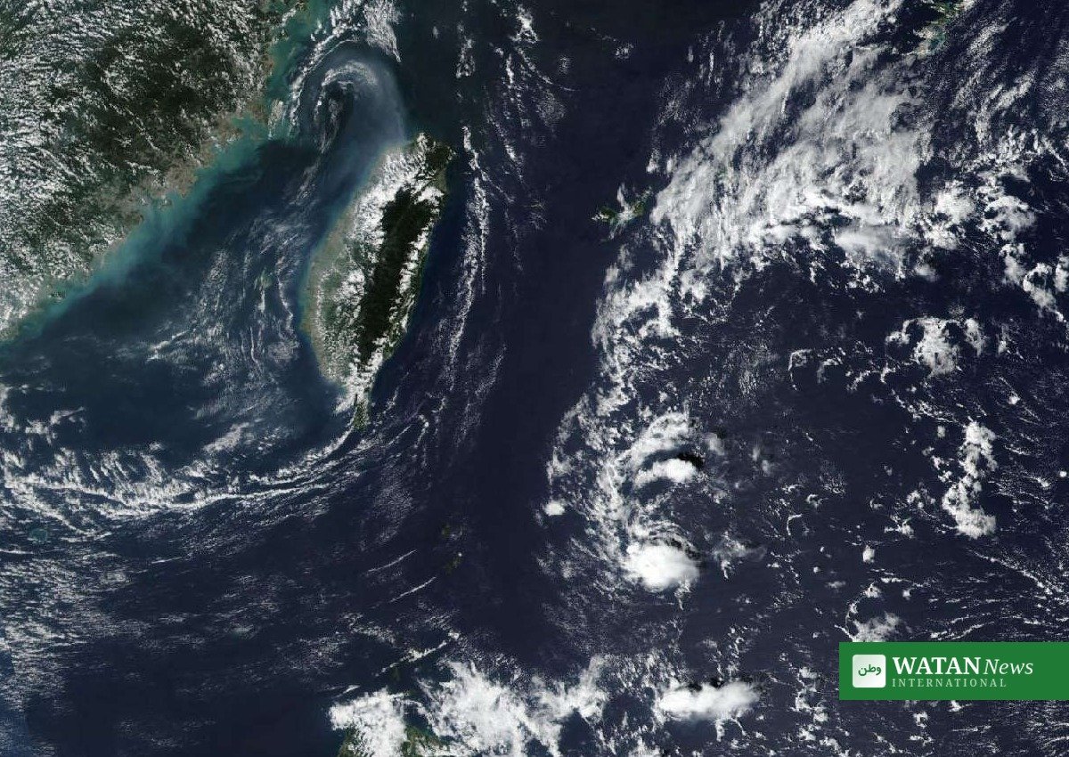
Forecast track: toward Taiwan after entering PAR
Champi will continue moving west-northwestward until it enters PAR on Tuesday, when it will be given the domestic name Rosal and become the Philippines’ 18th tropical cyclone this year. Afterward, the storm is expected to turn toward Taiwan while remaining over the Philippine Sea, gradually weakening from Thursday onward. By Saturday morning, Oct 24, PAGASA projects the system north of Itbayat, Batanes, back outside PAR, with winds reduced to 155 kph.
For continuing coverage of extreme weather and climate, see Watan News.
Author

usman2344913@gmail.com
Related Posts

Four Palestinians Killed in Gaza Despite Ceasefire
- 0
- 487 words
At least four Palestinians were killed in Israeli strikes and gunfire across the Gaza Strip on Tuesday, as the year-old Gaza ceasefire...
Read out all
EU bevilger 390 mio. euro til 135 nye LIFE-projekter for klima, natur og ren energi
- 0
- 722 words
Europa-Kommissionen bevilgede den 19. oktober 2026 mere end 390 mio. euro til 135 nye projekter under LIFE-programmet, EU’s flagskibsfinansieringsinstrument for miljø og...
Read out all
یورپی کمیشن کا 135 نئے لائف منصوبوں کے لیے 390 ملین یورو سے زائد کی گرانٹ کا اعلان
- 0
- 3 words
یورپی کمیشن نے 19 اکتوبر 2026 کو ماحول اور موسمیاتی ایکشن کے لیے یورپی یونین کے مرکزی فنڈنگ پروگرام، لائف پروگرام، کے...
Read out all
EU Grants €390 Million to 135 New LIFE Projects for Climate, Nature and Clean Energy
- 0
- 750 words
The European Commission on 19 October 2026 awarded more than €390 million to 135 new projects under the LIFE programme, the EU’s...
Read out all
Houthi Missile Strike Kills 58 at Yemen Training Camp, More Than 200 Injured
- 0
- 497 words
A Houthi missile strike in Yemen has killed at least 58 people and injured more than 200 at a government security forces...
Read out all
Alberta Votes to Remain in Canada in Historic Referendum, Rejecting Separation Path
- 0
- 784 words
EDMONTON, Alberta — Voters in Alberta have chosen to remain in Canada, decisively rejecting a referendum proposal that would have set the...
Read out all